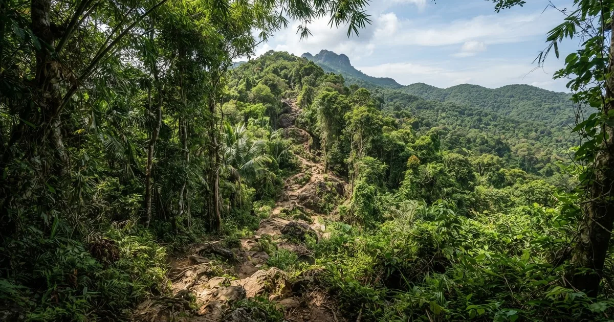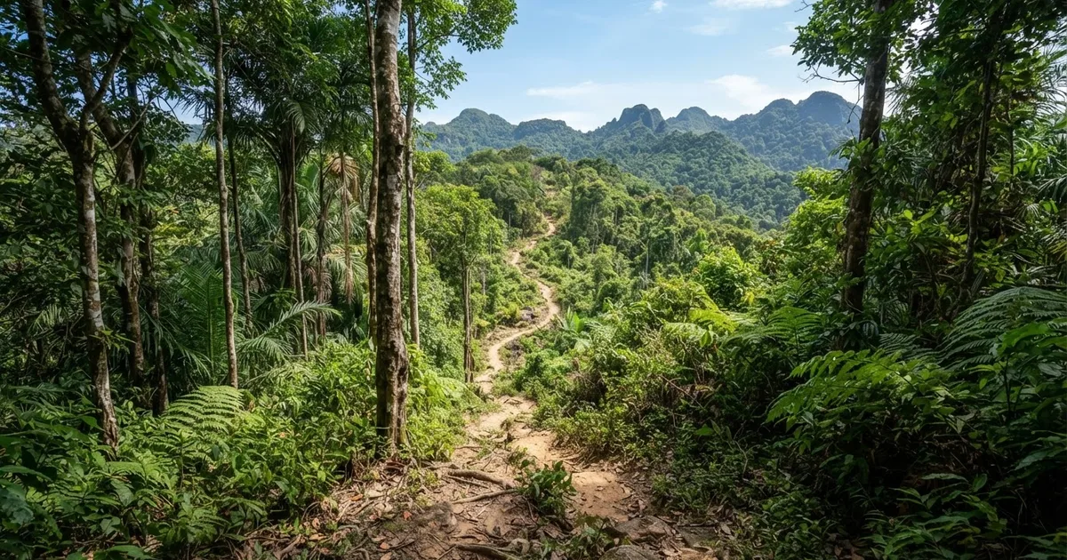
Phu Quoc National Park's marked trails are easier than most first-time visitors expect. The classic routes - Suoi Tien (4 km, around 3 hours) and Ganh Dau (5 km, around 3 hours) - are flat, beginner-friendly forest walks that need no guide, and even the longest marked trekking route in the park is only 9 kilometers. The real effort is saved for the Cua Can area, where moderate loop trails reach up to 10 km over 5-6 hours, and for the climb to Mount Chua, where dense forest makes a local guide essential.
What Kind of Park You Are Walking Into
Phu Quoc National Park is not a small nature reserve on the edge of town - it covers roughly 31,000 hectares, more than half of Phu Quoc Island, and forms the core of the Kien Giang UNESCO Biosphere Reserve. The main trailheads sit in the island's sparsely populated north and northeast, around the communes of Cua Duong, Cua Can, Ganh Dau and Bai Thom. From Duong Dong town, expect 30-60 minutes by scooter depending on which entrance you choose; Ganh Dau, for example, is roughly 30 km north.
Unlike the granite summits of northern Vietnam, this is lowland tropical forest. The island's highest point, Mount Chua (Nui Chua), tops out at just 603 meters, and the marked trails most visitors walk avoid big climbs altogether - the routes through the forest are mostly flat, with no large hills to conquer. What you get instead is genuine jungle: tall evergreen trees, tangled vines, shaded streams and a canopy that keeps the trail noticeably cooler than the coast.
Wildlife is shy but present. Hikers regularly report long-tailed macaques, hornbills, giant black squirrels and monitor lizards, plus a high density of butterflies in the early morning. Keep expectations realistic: this is a walk through living forest, not an open zoo, and the quieter your group, the more you will see.
Trail Difficulty at a Glance
The park's walking routes fall into three clear bands of difficulty. All of the marked options can be followed without a guide, and all reward an early start - several trails are best hiked in the early morning, both for cooler air and for wildlife.
| Trail | Distance | Time | Difficulty | Best for |
|---|---|---|---|---|
| Suoi Tien Trail | ~4 km | ~3 hours | Easy | Families, children, first-time hikers |
| Ganh Dau Trail | ~5 km | ~3 hours | Easy | Beginners, wildlife watchers |
| Central Trail (Rung Giong) | ~4 km | 2-3 hours round trip | Easy to moderate | Reasonably fit travelers |
| Cua Can loops | Up to 10 km | 5-6 hours | Moderate | Fitter hikers wanting a half-day trek |
| Longest marked route | 9 km | Half day | Moderate | Distance-minded hikers |
| Mount Chua (Nui Chua) | Varies | Full day | Demanding | Guided groups only |
Note the gap between marked and unmarked routes: everything in the table except Mount Chua can be walked independently. The moment you aim for the island's major climbs, the equation changes - the dense forest is genuinely easy to get lost in, and a local guide is highly recommended.
The Central National Park Trail (Rung Giong): The Signature Hike
If you only do one trek in the park, this is the one most guides describe. The Central National Park Trail, often called the Rung Giong Trail, runs about 4 kilometers and takes most people 2-3 hours round trip. It is rated easy to moderate: suitable for reasonably fit travelers with no special hiking experience, and even described in one recent guide as flat enough for families - though its footing tells a more demanding story.
The defining feature is water. The route crosses six streams, and you will be walking on slippery paths beside and through them for much of the way. Rocks are coated in moss and wet leaves, so traction - not fitness - is the main challenge. A hiking stick is recommended for added support, and most hikers simply wear sandals or old trainers they do not mind getting wet rather than trying to keep boots dry.
This trail is also the clearest illustration of why season matters. In the dry season, from October to April, the streams are shallow and the crossings are a fun, splashy highlight. During the rainy season, rising streams and the lack of bridges sharply increase the risk of accidents - this is one of the park's routes that should simply be skipped when water is high. It is a poor fit for anyone with knee or ankle problems, and not a good choice for small children after rain, despite its family-friendly reputation in dry months.
Suoi Tien and Ganh Dau: The Beginner Trails
Suoi Tien, roughly 4 kilometers and about 3 hours, is the park's most accessible walk. The trail through the forest is relatively easy, with mostly flat terrain and no large hills to climb - one guide describes it as flat enough for families with children. "Suoi Tien" means Fairy Stream, and the route follows water through shaded forest before reaching a small waterfall and pool area where you can cool off. Start early: the trail is best hiked in the morning, and by mid-afternoon the heat and the return leg both feel harder than they should.
Ganh Dau, about 5 kilometers in around 3 hours, sits near the island's northwest tip close to the Cambodian border. It shares the same character - an easy-to-follow forest path with no technical sections - but adds a slightly wilder feel because it sees fewer visitors. Combine it with a stop at Ganh Dau beach afterward, and you have one of the best easy half-days on the island.
Both routes can be walked without a guide; the paths are easy to follow. That said, a local guide adds real value even on easy trails if you care about spotting wildlife, learning which plants are edible or medicinal, and navigating the few unmarked junctions where logging paths intersect the main route.
Cua Can Loops and the Longest Route: For Fitter Hikers
The Cua Can area, in the park's northeast, offers the most serious marked walking on the island. Loop options run up to 10 kilometers and are rated moderate, taking about 5-6 hours. Expect rolling terrain, more stream crossings, longer stretches without shade breaks and far fewer people - on some sections you may walk for hours without meeting anyone. Bring more water than you think you need: two liters per person is a sensible minimum for a full loop.
The longest trekking route in Phu Quoc National Park is 9 kilometers, and it sits in the same moderate band as the Cua Can loops: no mountaineering, but a genuine half-day commitment through humid forest. These routes suit travelers who already walk or run regularly and want real distance, not a photo walk. They are a poor fit for young children, for anyone carrying heavy camera gear, and for visitors squeezing the hike between a beach morning and a sunset cruise - the 5-6 hour duration does not compress.
When to Go and How to Prepare
The best time to trek Phu Quoc National Park is the dry season, from October to April. Trails are firm, streams run low, and the six crossings on the Rung Giong route are safe and even enjoyable. In the rainy season, from roughly May to September, the same paths become slippery, streams rise, and the absence of bridges turns routine crossings into genuine hazards. Trekking should be avoided during heavy rainfall altogether - paths become slippery within minutes, and visibility in dense forest drops fast.
Timing within the day matters almost as much as the season. Several trails are best hiked early in the morning: temperatures on the island regularly exceed 32°C by midday, the forest is most active with wildlife before 9 a.m., and an early start leaves a comfortable buffer if you walk slower than planned.
Packing checklist for Phu Quoc National Park trails
- 2 liters of water per person for any trail over 4 km; more for Cua Can loops
- A hiking stick or a sturdy branch for the Rung Giong stream crossings
- Grippy sandals or trail shoes you do not mind soaking - not slick-soled sneakers
- Insect repellent and long, light trousers for leeches and mosquitoes in the wet months
- Rain jacket or poncho, even in the dry season - tropical showers arrive fast
- Offline maps downloaded before you leave Duong Dong; mobile signal fades deep in the forest
- Cash for trailhead parking and any village stops - cards are useless out here
One more practical note: there is no formal ticket office on most trailheads and no marked rescue infrastructure inside the forest. Tell your hotel or rental shop where you are going and when you expect to be back. If you are traveling solo or hiking in the shoulder months, hiring a local guide for even the easy trails is cheap insurance and directly supports families living around the park.
Frequently Asked Questions
How difficult is the main Phu Quoc National Park trail?
The Central National Park Trail (Rung Giong) is rated easy to moderate: about 4 km taking 2-3 hours round trip, suitable for reasonably fit travelers with no special experience. The challenge is footing, not fitness - it crosses six streams on slippery paths, so a hiking stick is recommended for support.
Do I need a guide to hike in Phu Quoc National Park?
Not for the marked trails - Suoi Tien, Ganh Dau and the Rung Giong route are easy to follow and can be walked independently. A local guide is highly recommended for major climbs like Nui Chua, where the dense forest is easy to get lost in, and adds wildlife-spotting value on easy trails too.
What is the longest trekking route in Phu Quoc National Park?
The longest marked trekking route is 9 kilometers. The Cua Can area also offers loop trails up to 10 km, rated moderate and taking about 5-6 hours. These are the most demanding marked options on the island; everything shorter, like the 4 km Suoi Tien trail, is beginner-friendly.
Is the Suoi Tien trail suitable for children?
Yes. Suoi Tien is about 4 km and takes around 3 hours, described as beginner-friendly and flat enough for families and children, with mostly flat terrain and no large hills to climb. Start early in the morning, bring water and snacks, and avoid the trail during or after heavy rain when paths turn slippery.
When is the best time to trek Phu Quoc National Park?
The dry season from October to April is best: streams run low and trails stay firm. During the rainy season, rising streams and the lack of bridges increase accident risk, especially on the Rung Giong route with its six crossings. Never trek during heavy rainfall, and favor early morning starts year-round.
How do I get to the park trailheads from Duong Dong?
Trailheads in the north and northeast are 30-60 minutes by scooter from Duong Dong; Ganh Dau is roughly 30 km north. Be warned that access is difficult because the roads are dreadful, with rough dirt sections on final approaches, and some forest parts are sometimes used by the army - respect all barriers and signage.
Can I combine a park hike with other Phu Quoc activities in one day?
Yes, if you start early. A 2-3 hour Rung Giong or Suoi Tien hike finished by late morning leaves time for an afternoon at a north-coast beach like Ganh Dau or Bai Thom. The 5-6 hour Cua Can loops, however, effectively consume a full day and should not be squeezed around other plans.
Planning to trek Phu Quoc National Park? Sabrina Rental can set you up with a reliable scooter for the rough roads to the trailheads, arrange a local hiking guide for the Nui Chua climb, and share up-to-date trail and weather advice from the island. Just ask - we are based right here on Phu Quoc.
Contact Sabrina Rental