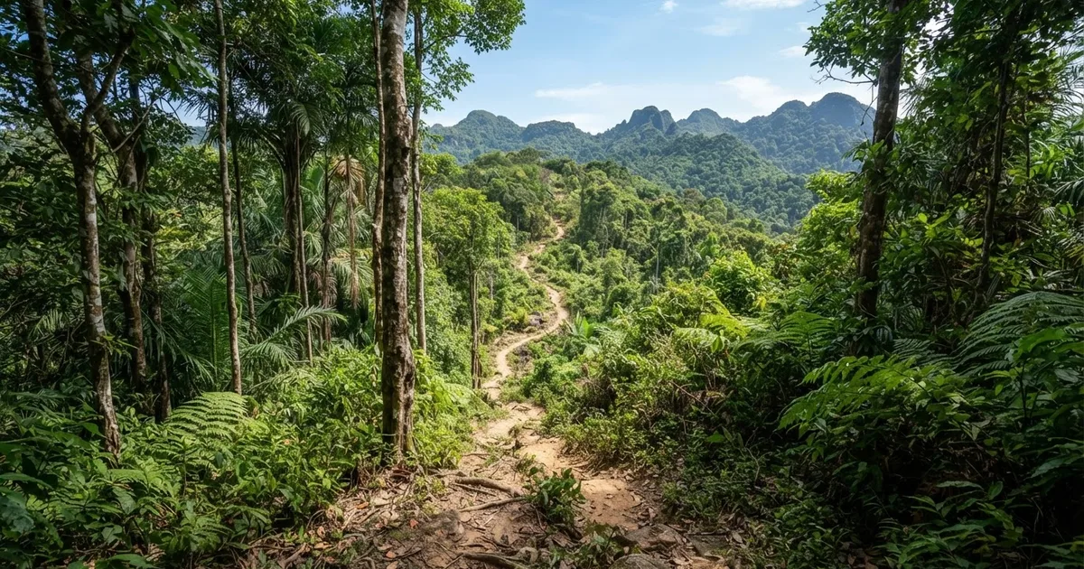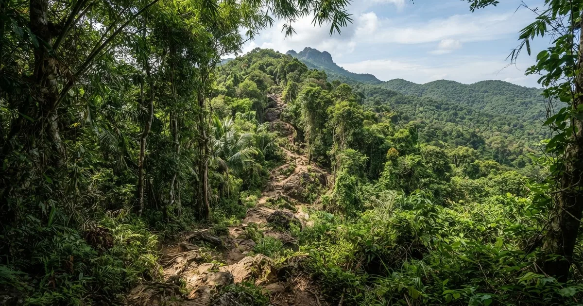
The Mount Chua Trail is a moderate-to-hard or challenging hike to Phu Quoc’s highest point, 603 metres above sea level. Published route descriptions vary considerably: some list approximately 7.5 kilometres and 2.5 hours round trip, while a stricter full-route description lists more than 15 kilometres and 7–9 hours of continuous trekking. Treat it as a serious forest hike rather than a casual viewpoint walk, and confirm current access and guide requirements before setting out because Mount Chua lies in a strictly protected area of Phu Quoc National Park.
How difficult is the Mount Chua Trail?
Mount Chua is the most demanding and potentially the most rewarding hike in the Phu Quoc National Park trail group. It is not an extreme alpine climb, but tropical heat, humidity, slippery ground, roots, uneven slopes and a long return journey can make the effort substantially harder than the elevation figure suggests. Most practical descriptions place it between moderate and hard, while a more demanding full-route description rates it very hard.
The main difficulty is cumulative. You may begin in warm, shaded forest, but the combination of climbing, damp footing and limited opportunities to buy water can quickly drain energy. A trail that feels manageable during the ascent can become tiring on the descent, especially after rain. Fit hikers who regularly walk hills or spend several hours outdoors are the best candidates. Beginners should choose a shorter National Park route first rather than treating Mount Chua as an introductory walk.
There is no single universally consistent published measurement for the route. One description records about 7.5 kilometres round trip and roughly 2.5 hours, while another describes a full trek of more than 15 kilometres taking 7–9 hours of continuous trekking. This difference may reflect separate access points, route extensions, turnaround points or different interpretations of the Mount Chua trail. Ask the operator or ranger for the exact route length, elevation profile and expected finish time before departure.
A good fit for
Fit hikers who want Phu Quoc’s highest summit, accept changing trail conditions and are prepared to walk for several hours in a hot, humid forest.
A poor fit for
Visitors seeking an easy family walk, travelers with limited mobility, anyone without suitable shoes, and people unwilling to hike with a local guide where protected-area rules require one.
Distance, time and why route reports differ
For planning purposes, use the shorter published figure only if your local guide confirms that you are taking the short Mount Chua route. That version is approximately 7.5 kilometres round trip and is described as taking about 2.5 hours. Even at that length, the route should not be judged solely by its distance: wet rocks, exposed roots and a steady climb can slow progress significantly.
The longer account describes more than 15 kilometres and approximately 7–9 hours of continuous trekking. This is a full-day commitment, particularly if the group takes breaks, waits for slower hikers or encounters mud and rain. Carry enough food and water for the confirmed itinerary rather than assuming a short walk. A late return is an avoidable risk when daylight, weather and trail conditions are changing.
| Published route description | Distance | Walking time | How to use the information |
|---|---|---|---|
| Short Mount Chua route | About 7.5 km round trip | About 2.5 hours | Use only after confirming the access point and turnaround with a local guide. |
| Full Mount Chua trek | More than 15 km round trip | About 7–9 hours | Plan as a full-day, demanding hike with substantial water and food. |
| Central National Park Trail | 4 km | About 2–3 hours | A shorter alternative, but streams and slippery paths still require care. |
| Cua Can area trails | Loop options up to 10 km | About 5–6 hours | A moderate alternative for hikers wanting more distance without Mount Chua’s summit objective. |
When booking, ask four specific questions: which trailhead will be used, whether the quoted distance is round trip, whether transport time is excluded and how long the group is expected to spend walking continuously. These details explain why two apparently reliable descriptions can show such different figures. Do not book a “2.5-hour Mount Chua hike” and assume it represents the full long-distance route.
What the trail is like on the ground
Mount Chua is a tropical forest hike rather than a paved summit attraction. Expect dense vegetation, natural surfaces, tree roots, damp soil, rocks and sections where the exact line of the path may not be obvious. The forest provides shade, but shade does not remove the heat: humidity remains high, and your pace should be slower than it would be on a dry, marked hillside.
Footing is often the most important practical issue. A dry root or rock can become slick after a short shower, while mud can collect in lower sections and make the descent particularly awkward. Use shoes with a firm tread and secure laces. Lightweight sandals, smooth-soled trainers and flip-flops are poor choices. Trekking poles or a simple walking stick can help with balance, although a stick does not replace careful foot placement.
Do not assume that reaching the highest point guarantees a wide, clear panorama in every direction. Vegetation, cloud, haze and the precise summit viewpoint affect what you can see. The reward is the experience of reaching Phu Quoc’s 603-metre high point and the possibility of elevated forest and island views, not a guaranteed cloudless lookout. Build time into the itinerary for safe stops rather than rushing to take photographs.
Practical tip: Keep your phone, camera and spare clothing in a waterproof bag. A tropical shower can arrive quickly, and a wet device is more difficult to protect during a long return walk.
When should you hike Mount Chua?
The standard recommended hiking season is the dry season from November through April. Another seasonal guide identifies February through June as an optimal window because rainfall is generally lower and sunshine is more abundant. These periods overlap from February through April, which is the safest planning compromise when you want a lower probability of saturated ground and rising streams.
The February-to-June recommendation extends into a period when conditions can become hotter and rainfall may begin increasing. Check the forecast close to the departure date rather than relying only on a calendar. A clear morning does not guarantee a dry afternoon in Phu Quoc, and conditions inside the forest can be wetter than those at your hotel or on the coast.
The rainy season demands extra caution. Heavy rain can make slopes slippery, obscure trail markings and increase the chance that a planned hike will take longer. For a route that may be more than 15 kilometres and 7–9 hours, even a modest delay matters. A guide should be willing to postpone or cancel the hike when conditions are unsafe; a fixed booking is not a reason to cross a swollen stream or continue onto unstable ground.
| Period | Typical planning guidance | Main concern |
|---|---|---|
| November–January | Generally within the dry-season hiking window | Residual wet ground can remain after earlier rain. |
| February–April | Strongest overlap of the recommended dry-season windows | Heat and sun exposure can still be significant. |
| May–June | Still cited by some guides as a good period | Increasing heat and possible showers require flexible planning. |
| Rainy season | Attempt only after a current local conditions check | Mud, slippery footing, poor visibility and delayed returns. |
Access, permits and guide requirements
Mount Chua is reported to lie inside the strictly protected zone of Phu Quoc National Park. One recent guide states that independent tourism is prohibited in this area. This is the most important access issue to resolve before you travel: do not assume that a location shown on an online map is legally open for self-guided hiking.
Rules, conservation restrictions and route availability can change. Contact the National Park authority, a current licensed local operator or a trusted Phu Quoc concierge before departure. Ask whether a permit is required, whether a ranger or approved guide must accompany the group, which entrance is currently authorised and whether the Mount Chua summit route is open on your chosen date.
A local guide is valuable for more than navigation. The guide can identify a safe route around wet ground, judge stream and weather conditions, manage the pace of a mixed group and communicate with local authorities. If an operator cannot clearly explain the route, access permission and emergency plan, choose another provider. Do not enter a restricted forest zone by following an old blog, a dropped map pin or an unverified social-media track.
Confirm before you pay
- Is the route officially open on your date?
- Is the quoted 7.5 km or more-than-15-km distance measured round trip?
- Is an approved guide or ranger included?
- What is the meeting point and how much transport time is excluded?
- What happens if rain makes the trail unsafe?
- Who carries the first-aid kit and handles an emergency?
What to pack for the Mount Chua hike
Pack for the confirmed itinerary, not the shortest number found online. A 2.5-hour outing and a 7–9-hour continuous trek require different quantities of water, food and spare clothing. There may be no reliable shop, refill point or mobile signal on the trail, so leave the trailhead prepared.
- Water: carry enough for the full confirmed route, with extra capacity for heat and delays. Your guide can advise on the amount for the day’s conditions.
- Food: bring a practical packed meal and high-energy snacks for any route longer than a short walk.
- Footwear: choose closed hiking shoes with good grip and secure ankle support where comfortable.
- Clothing: wear breathable, quick-drying clothing and pack a light rain layer. Long trousers can reduce scratches and insect exposure.
- Protection: bring sunscreen, insect repellent, a hat and a waterproof bag for valuables.
- Safety equipment: carry a small first-aid kit, personal medication, a fully charged phone and a power bank. A whistle can be useful in a forest environment.
- Support: a hiking stick or trekking pole is sensible on wet, uneven ground, particularly during the descent.
Keep your day pack light enough to carry comfortably but do not cut essential supplies to save weight. Wear-in new shoes before the hike, trim loose straps and protect electronics before entering the forest. Tell the guide about medical conditions, allergies and previous hiking injuries before the group starts.
Safer alternatives if Mount Chua is too difficult
Mount Chua is not the only way to experience Phu Quoc National Park. The Central National Park Trail, also known as the Rung Giong Trail, is a 4-kilometre route often described as relatively flat and suitable for families and beginners. Other descriptions rate it easy to moderate for reasonably fit travelers without special experience. It usually takes approximately 2–3 hours round trip, making it a better first forest walk.
However, the Central Trail is not completely effortless. It crosses six streams, includes slippery paths and may have no bridges across some watercourses. A hiking stick is recommended for additional support. The dry season from October through April is generally considered the best time for this route. During the rainy season, rising streams and the lack of bridges increase the risk of accidents, so do not confuse “shorter” with “safe in every weather condition.”
The Cua Can area trails offer another option for visitors who want a longer forest experience without committing to the Mount Chua summit. These routes are described as moderate, with loop options up to 10 kilometres taking approximately 5–6 hours. They may suit hikers who are reasonably fit but do not need to reach Phu Quoc’s highest point.
| Route | Difficulty | Distance and time | Best for |
|---|---|---|---|
| Mount Chua | Moderate to hard; challenging to very hard on the full route | About 7.5 km and 2.5 hours, or more than 15 km and 7–9 hours depending on the route | Fit hikers seeking the island’s highest summit and a demanding forest day. |
| Central National Park Trail | Easy to moderate, with slippery sections | 4 km and about 2–3 hours | Families, beginners and travelers wanting a shorter forest walk. |
| Cua Can trails | Moderate | Loops up to 10 km and about 5–6 hours | Reasonably fit hikers wanting more distance without the Mount Chua objective. |
Choose an alternative if anyone in your group has little walking experience, is uncomfortable with wet streams or cannot commit to the longer return time. A shorter route is a better trip than an ambitious summit attempt that has to be abandoned halfway through.
Suggested day plan and realistic expectations
Start early enough to avoid the strongest midday heat and to preserve daylight for the return. The exact departure time should be set by the guide after considering the confirmed route, transport time and forecast. For the long version, allow a full day rather than scheduling another major activity afterward. Even the shorter version can take longer than 2.5 hours if the group stops for photographs or encounters wet ground.
At the trailhead, check footwear, water, food, weather protection and communications. Ask the guide to identify the turnaround point and the planned emergency procedure. Walk at the pace of the least experienced participant, drink regularly and take short breaks before fatigue becomes severe. On descents, shorten your steps and keep three points of contact where the ground is slick.
At the summit or viewpoint, stay on the established route and do not climb unstable trees or rock faces for a photograph. Keep food and litter with you, avoid disturbing wildlife and leave plants, stones and other natural features in place. Protected forest is part of the attraction, and responsible behaviour helps preserve access for future visitors.
Frequently Asked Questions
How hard is the Mount Chua Trail?
Mount Chua is generally rated moderate to hard or challenging. A more demanding full-route description rates it very hard. Heat, humidity, slippery ground and the return distance matter as much as the 603-metre summit, so it is better suited to fit hikers than beginners.
How long is the Mount Chua Trail?
Published figures differ. One route description gives approximately 7.5 kilometres round trip, while another gives more than 15 kilometres for the full trek. Confirm the exact trailhead, turnaround point and whether the distance is round trip before booking or setting out.
How long does the Mount Chua hike take?
The shorter route is described as taking about 2.5 hours round trip. A longer full-route description estimates 7–9 hours of continuous trekking. Allow extra time for breaks, photographs, slow conditions, rain and transport, and do not schedule a second demanding activity afterward.
What is the best month to hike Mount Chua?
The broad recommended season is the dry season from November through April. Another guide identifies February through June as an optimal window because rainfall is lower and sunshine is more reliable. February through April is the clearest overlap, but always check current weather and trail conditions.
Can I hike Mount Chua without a guide?
Do not assume that independent hiking is allowed. Mount Chua is reported to be inside a strictly protected zone of Phu Quoc National Park, where independent tourism may be prohibited. Confirm current rules with the National Park authority or a current local operator and use an approved guide if required.
What should I wear for Mount Chua?
Wear closed shoes with a firm, grippy sole, breathable quick-drying clothing and a light rain layer. Long trousers can protect against scratches and insects. Avoid flip-flops and smooth-soled trainers because roots, mud and wet rocks can become slippery after rain.
Is Mount Chua suitable for children?
The full Mount Chua route is not a sensible default for young children because descriptions range from 7.5 kilometres to more than 15 kilometres and from 2.5 hours to 7–9 hours. Families should consider the 4-kilometre Central National Park Trail, after checking stream levels and current conditions.
What is the easiest alternative to Mount Chua?
The Central National Park Trail, or Rung Giong Trail, is usually the more accessible alternative. It is approximately 4 kilometres and takes about 2–3 hours, although it crosses six streams and includes slippery paths. The Cua Can trails are a moderate option with loops up to 10 kilometres.
Contact Sabrina Rental for current local advice, route planning, transport help and reliable guidance on whether Mount Chua or a shorter National Park trail suits your group.
Contact Sabrina