The Ham Ninh Mountain trail is the most challenging of Phu Quoc National Park's established hikes: a roughly 5.2-kilometre route gaining about 580 metres, which takes a fit walker 1 to 3 hours to climb each way. Entry is free, the October-to-May dry season is the window to do it, and it demands a noticeably higher fitness level than the island's easier forest walks — it is best done with a local guide.
How Hard Is the Ham Ninh Mountain Trail Really?
Honest answer: it is a proper hike, not a stroll. Every credible trail listing agrees that the Ham Ninh Mountain Trek is the most demanding option among Phu Quoc National Park's routes, with the most rewarding views as compensation. It is consistently described as "not for everyone" and requiring a higher level of fitness than the Ganh Dau Trail, the island's other well-known forest walk. If Ganh Dau is a shaded nature ramble, Ham Ninh is a genuine mountain ascent with sustained climbing, uneven footing and a steep, knee-testing descent.
The numbers tell the story. A 2026 trekking guide measures the ascent at about 5.2 kilometres gaining roughly 580 metres over about three hours; other park listings put the trek at around 6 km with a 1–3 hour trekking time, and at least one shorter description counts roughly 3 km. These variations usually come down to different starting points on the Ham Ninh range and one-way versus round-trip counting — which is precisely why confirming the exact start point and distance with someone local matters before you set off.
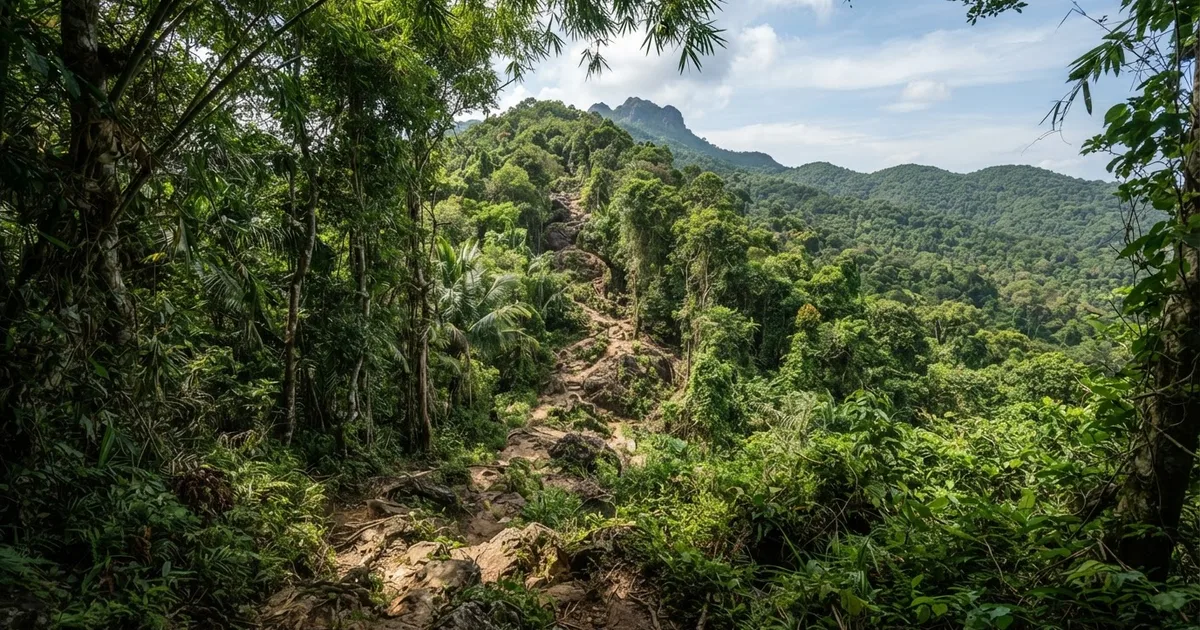
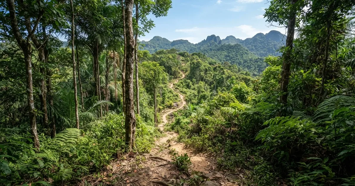
What you should absolutely not expect is a flat forest path. You will be climbing through dense woodland on dirt, roots and rock for most of the ascent, sweating hard in tropical humidity, and navigating sections that become genuinely slippery after rain. The flip side: the summit delivers the panoramic ocean and east-coast views that no other trail on the island can match, which is why experienced hikers rank it as the most rewarding hike in Phu Quoc.
Ham Ninh vs the Island's Other Park Trails
To judge whether Ham Ninh is the right trail for you, it helps to see it next to Phu Quoc's other classic walks:
| Trail | Distance | Time | Difficulty | Best season |
|---|---|---|---|---|
| Ham Ninh Mountain Trail | ~5.2–6 km one way, ~580 m gain | 1–3 hrs each way | Moderate–challenging | October–May |
| Rung Giong / Central National Park Trail | ~4 km round trip | 2–3 hrs | Easy–moderate | October–April |
| Ganh Dau Trail | Short, low-gradient forest walk | 1–2 hrs | Easy | October–May |
Note that the Central (Rung Giong) Trail sits in an awkward middle ground: one 2026 guide calls it relatively flat and suitable for families and beginners, while other descriptions highlight that it crosses six streams on slippery paths and recommend a hiking stick. It takes about 2 to 3 hours round trip and involves far less effort than Ham Ninh, but footing can still be tricky. Ham Ninh, by contrast, is the only one of the three where physical conditioning — not just caution — is a genuine factor.
Who is this trail a poor fit for? Anyone with knee, hip or heart problems, families with young children, first-time hikers with no hill experience, and visitors arriving in the rainy season (June–September) when the surface turns to mud. If you want a Phu Quoc forest experience without the grind, choose the Rung Giong or Ganh Dau Trail instead. Ham Ninh is for reasonably fit, experienced hikers who specifically want the panoramic ocean views from the peak.
The Route: What You Will Actually Walk
The trail starts from the Ham Ninh area on Phu Quoc's east coast, a fishing-village district roughly 20 km east of Duong Dong, and climbs into the Ham Ninh mountain range that forms the island's spine. Your route gains about 580 metres over roughly 5.2 kilometres, and the lower section passes through thick tropical forest where the canopy keeps things cool but the trail underfoot is a tangle of roots, loose rock and packed red earth.
Expect three distinct phases. The first hour is a steady warm-up climb; the middle section steepens, and this is where less-fit hikers start counting their remaining water; the final push is stony and steepest, demanding short steps and occasional hands-on-rock balance. On the way down, the strain moves to your knees and ankles — steep descents are where most minor injuries on this trail happen, so poles or a sturdy stick genuinely help.
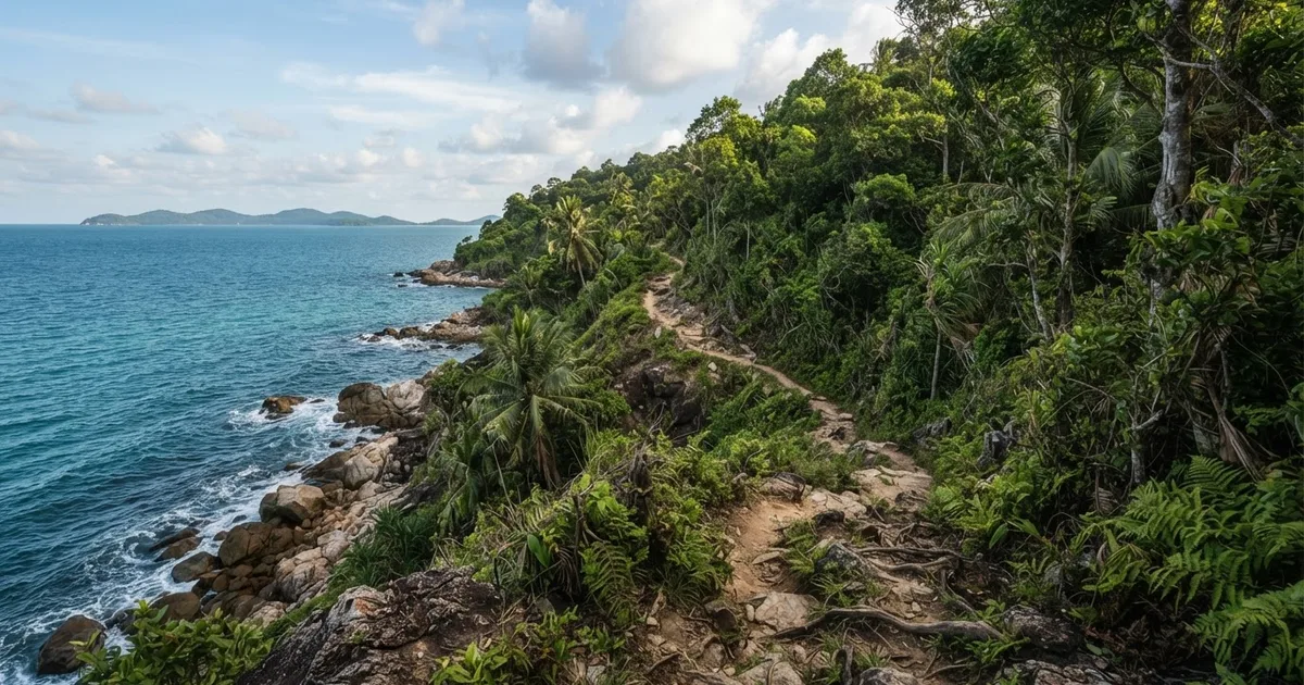
The summit is the reason you came. From the peak you get a breathtaking, unbroken view across the island's east coast to the sea, with fishing boats scattered below and, on clear mornings, the sun rising over Vietnam's mainland. Locals typically set off at first light to summit before the midday heat, which also gives the clearest skies for photography.
Best Time of Year and Best Time of Day
The best months for the Ham Ninh Mountain Trek are October to May, Phu Quoc's dry season. In this window the trail surface is firm, streams are low, and skies are usually clear enough for the summit views. The Central National Park Trail is likewise best from October to April, so the whole island's hiking calendar runs on the same season logic.
Avoid the rainy season, roughly June to September. On the milder Rung Giong Trail, rising streams and a lack of bridges already increase the risk of accidents in the rains; on a steep mountain ascent like Ham Ninh, wet granite and slick red clay make the route genuinely hazardous. Start your hike by 7 a.m. at the latest in any season: you want to be descending by early afternoon, when tropical heat and sudden showers are at their peak.
Tip: Pack at least 2 litres of water per person, more if you are a slow climber. There are no water sources, stalls or shelters on the trail itself — the nearest supplies are in Ham Ninh village at the foot of the range.
Packing List and Safety Checklist
- Grippy trail shoes or hiking boots — smooth-soled sneakers struggle on wet roots and rock
- 2+ litres of water per person and salty snacks for the climb
- Lightweight long sleeves and trousers — protection from insects, scratches and sun
- Hiking stick or pole, especially for the descent
- Offloaded offline map plus a fully charged phone; mobile signal fades on the ridge
- Light rain shell, even in dry season
- Leave your expected return time with your hotel or guide before you start
A 2026 trekking guide makes a sensible recommendation: do Ham Ninh only with a guide who can confirm the starting point, distance, elevation, surface, water plan, expected return, and current permission status. Trailheads around Ham Ninh are not uniformly signposted, routes shift with the seasons, and park access rules can change — a local guide removes all of that uncertainty, which is exactly what the free-entry status of the Ham Ninh area makes it easy to arrange cheaply.
Getting to the Trailhead
From Duong Dong, the most scenic route is the coastal road along the east of the island to Ham Ninh village, roughly a 40–50 minute ride. A rented motorbike is the most flexible option and lets you start early; scooters are cheap on Phu Quoc, though you should check brakes and tyres before riding mountain roads. Taxis and private cars work too, but agree a pickup time and place in advance, since drivers are scarce in the village during the day.
Because the exact trailhead varies depending on which route your guide uses, confirm the meeting point the evening before. Arriving in Ham Ninh village itself is worth an hour regardless: the stilt-house fishing village and its seafood stalls make a good recovery meal after you come down off the mountain.
Frequently Asked Questions
How long does the Ham Ninh Mountain trail take?
Plan on 1 to 3 hours to climb, depending on fitness, plus a shorter descent and time at the summit. Most hikers complete the round trip in 5 to 6 hours including breaks, so start by 7 a.m. to be back in Ham Ninh village by early afternoon.
Is there an entrance fee for the Ham Ninh Mountain trail?
No. The Ham Ninh area required no tickets and was a free access point for independent hikers as of the 2026 season. You only pay if you hire a local guide, which is recommended, or arrange transport to the trailhead.
Can a beginner hike Ham Ninh Mountain?
Not recommended. The route gains about 580 metres over 5.2 km on steep, rooty terrain and requires a higher fitness level than the Ganh Dau Trail. Beginners should try the Rung Giong Central Trail, a 4 km, 2–3 hour easy-to-moderate walk, first.
Do I need a guide for Ham Ninh Mountain?
Strongly recommended. A guide confirms the starting point, distance, elevation, surface, water plan, expected return and current permission status, all of which vary with the season. Going alone risks a wrong trailhead, no water plan and no one aware of your return time.
When is the best time to hike Ham Ninh Mountain?
October to May, Phu Quoc's dry season, when the trail is dry and views are clear. Avoid June to September, when rain makes the steep surface dangerously slippery. Within any day, start at sunrise to beat the heat and get the best visibility from the peak.
How high is Ham Ninh Mountain in Phu Quoc?
The Ham Ninh range tops out at around 603 metres on Nui Chua, the island's highest point. The standard hiking route gains roughly 580 metres of elevation over a 5.2-kilometre ascent, making it the most physically demanding of the national park's trails.
How do I get to the Ham Ninh trailhead from Duong Dong?
Ride east along the coastal road to Ham Ninh fishing village, about 20 km and 40–50 minutes by motorbike or car. Confirm the exact trail start with your guide the evening before, since starting points on the range differ between routes.
Planning to hike Ham Ninh Mountain? Sabrina Rental on Phu Quoc can set you up with a reliable motorbike for the ride to the trailhead, arrange a trusted local guide, and advise on conditions before you go. Contact us and we will get you sorted.
Get Local Help from Sabrina Rental