The Cua Can paths in Phu Quoc National Park are rated easy to moderate: you can pick a 2 km loop that takes 1-1.5 hours or commit to a full circuit of up to 10 km that needs 5-6 hours. There is no technical climbing — the difficulty comes from distance, humidity, mud and stream crossings rather than exposure or steep scrambles. A guide is not required on at least some routes, though hiring one for about $15-30 is strongly recommended on the poorly marked branches, and the whole area is best hiked in the dry season from October to May.
How hard are the Cua Can paths, really?
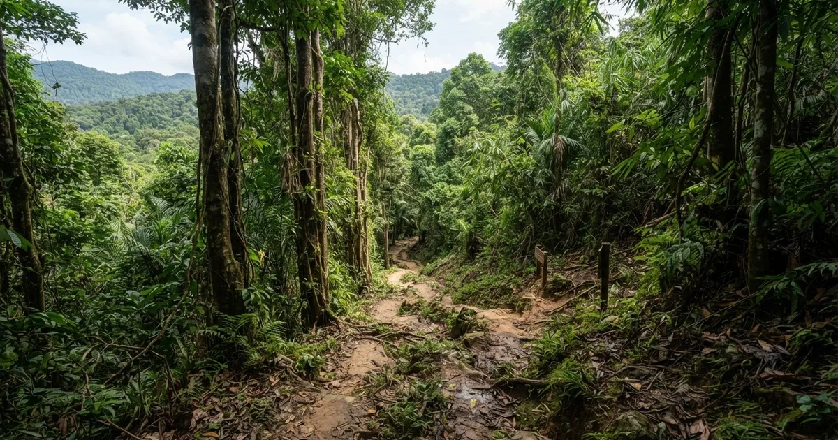
The official rating for the Cua Can area trails is moderate, and that label is accurate — but it helps to understand what moderate means here. None of the routes involve scrambling, ropes or exposed ridges. The hills in this sector of Phu Quoc National Park top out around 280 meters, and the surface underfoot is packed earth and leaf litter beneath dense evergreen canopy. What earns the moderate rating is the combination of distance, humidity and terrain: roots to trip over, mud after rain, and repeated creek crossings that slow your pace to a careful shuffle.
If you are reasonably fit and comfortable walking 5-6 hours on uneven ground, the full 10 km circuit is very achievable. If you are new to hiking or short on time, the 2 km loop near the trailhead delivers the same jungle atmosphere in 1-1.5 hours. The honest answer to how hard Cua Can is: exactly as hard as the loop you choose.
Easy
The short Cua Can nature loop: about 2 km round trip, 1-1.5 hours, gentle ground, suitable for most travelers including older children.
Moderate
The Rung Giong Trail (4 km, six stream crossings) and the full Cua Can circuit (up to 10 km, 5-6 hours). Demanding by distance and slippery footing, not by climbing.
Challenging
The longer forest trek of 6+ km that ascends to about 280 meters. Described by hikers as challenging yet rewarding — the hardest option in the area, best done with a guide.
One more factor people underestimate: heat and humidity. Even under canopy, midday temperatures on Phu Quoc sit around 30°C with humidity above 70%, so a flat 4 km can feel like twice the effort. Start early, drink more water than you think you need, and the moderate rating will feel fair rather than punishing.
The Cua Can routes at a glance
There is no single Cua Can trail — the name covers a network of paths branching through the river valley of the same name in the national park's northern sector. These are the options trekkers most often choose between:
| Route | Distance | Time | Difficulty |
|---|---|---|---|
| Short Cua Can nature loop | ~2 km round trip | 1-1.5 hours | Easy |
| Rung Giong Trail (Central National Park Trail) | 4 km | 2-3 hours round trip | Easy-moderate, six stream crossings |
| Long forest trek from Cua Can | 6+ km, up to 280 m ascent | Half day | Challenging yet rewarding |
| Full Cua Can circuit | Up to 10 km | 5-6 hours | Moderate |
| Nui Da Bac (same northern sector) | Round trip | 2-3 hours | Moderate, can be done without a guide |
The Rung Giong Trail deserves a note because guides describe it two different ways. One calls it relatively flat and suitable for families and beginners, with a 2-3 hour round trip; another lists it as more challenging than the easier park routes because it requires crossing six streams on slippery paths. Both descriptions are true. The gradient is gentle, but those six crossings — stepping stones and slick rocks, with no bridges — make it more work than 4 km sounds on paper. If you go, bring a hiking stick for added support; it genuinely helps on the wet stones.
The 6+ km trek climbing to 280 meters is the one to respect. It is the route reviewers call challenging yet rewarding, and it is where the 5-6 hour estimate for the area really applies. Do not attempt it late in the day or alone without navigation.
What the trail is like underfoot
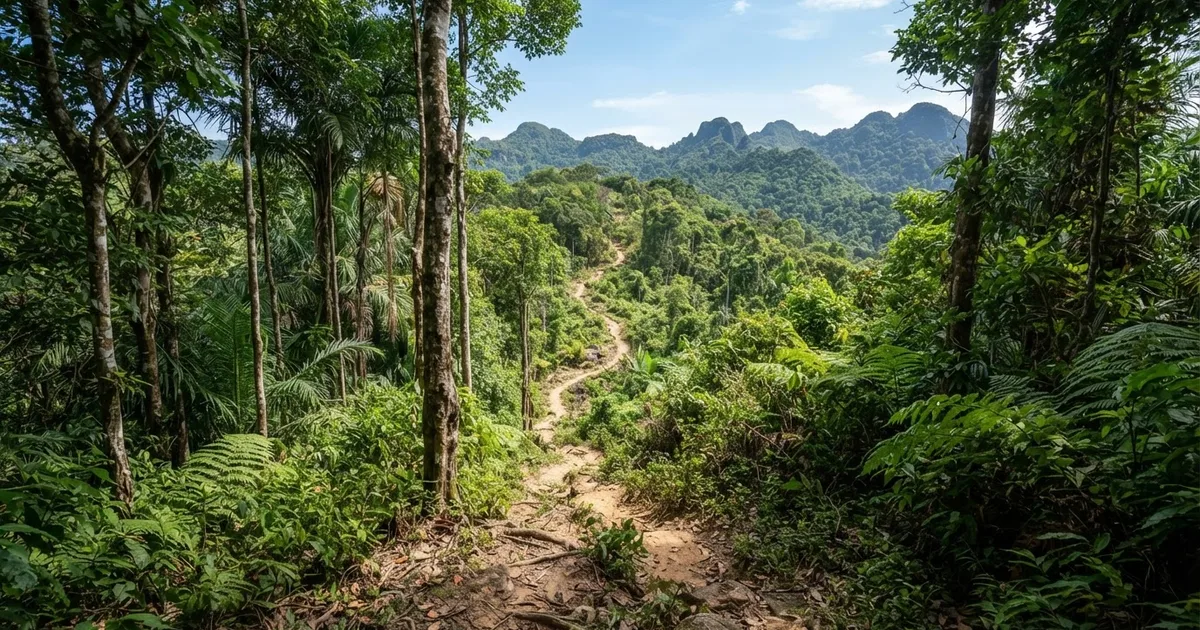
Expect classic Vietnamese island jungle: dense green canopy, a constant soundtrack of birds and insects, and creeks you cross on foot rather than on bridges. The paths themselves are a mix of packed dirt, exposed roots, fallen leaves and — after any rain — long stretches of slick mud. In the dry season the footing stays firm most of the way; in the wet season the same ground becomes a mud chute in places.
Navigation is the other honest difficulty. The main routes are findable, but side branches fork off with little or no signage, and inside the forest one dirt path looks much like another. Trekkers consistently describe the Cua Can trails as poorly marked, which is the single best argument for a guide if you plan anything longer than the short loop. Download an offline map, keep the river on a known side, and turn back the moment a path stops matching your expectations.
The reward for all this is exactly what the area is known for: dense forest, birds and creek crossings that make it a favorite of nature lovers and eco-tourists. Bring binoculars if you have them — the birdlife along the watercourses is the highlight for many hikers, and you will hear far more than you see. Long trousers and repellent are non-negotiable; ants, mosquitoes and the occasional leech are part of the package in Vietnamese lowland jungle.
Do you need a guide for the Cua Can paths?
Strictly, no — a guide is not required for at least some of the routes in Phu Quoc National Park, and entry to the park is generally free. The 2 km loop and the Rung Giong Trail are both walked independently by plenty of travelers, and the nearby Nui Da Bac trek (2-3 hours round trip, moderate) is explicitly doable without a guide.
Practically, it depends on which route and which season. A guide costs about $15-30 and is strongly recommended on the poorly marked trails — which describes most of the Cua Can network beyond the short loop. What you get for that money is navigation, stream-crossing judgment (a local knows instantly whether a rising creek is safe), and a running commentary on the plants and birds you would otherwise walk straight past. Some trekking routes and eco-tours may charge a small fee or require a guide even where entry itself is free, so ask before setting out rather than at the trailhead.
Tip: If you hike independently, stick to the 2 km loop or Rung Giong in the dry season, start before 8 am, and tell your guesthouse where you are going. Save the 10 km circuit and the 280 m ascent for a guided day — that is where the $15-30 earns itself back.
The best time to hike the Cua Can paths
Timing matters more here than on any beach day. The dry season from October to May is the best window for the Cua Can area, and the narrower November-to-April stretch is even safer: trails are firm, creeks run shallow, and the forest is at its most walkable. Within a given day, start at dawn or early morning — you will finish before the peak heat and leave a buffer if a 5-6 hour circuit runs long.
From June to October the southwest monsoon takes over, and guides are blunt about it: avoid the wet season. Rain makes the trails slippery and treacherous, and on routes like Rung Giong the streams rise with no bridges to fall back on — the lack of bridges combined with rising water is exactly the accident scenario local warnings describe. A trail that was a pleasant stroll in March can be a knee-deep wading exercise in August.
If your trip falls in the wet months, you are not entirely out of luck: short dry spells do occur, and the 2 km loop right after light rain is manageable with decent shoes. But treat any longer Cua Can route as off the table unless a local guide tells you conditions are safe that morning.
Who the Cua Can paths suit — and who they don't
Be honest with yourself about the fit before you commit a day to this. The Cua Can paths are genuinely one of the best half-day or full-day nature experiences on Phu Quoc, but they are a jungle walk, not a viewpoint hike, and that shapes who enjoys them.
- You will love it if: you are a nature lover or eco-tourist — dense forest, birds and creek crossings are the whole point.
- You will love it if: you want a flexible challenge, from a 1.5-hour taster to a 5-6 hour moderate circuit.
- You will love it if: you are a reasonably fit beginner looking for your first Southeast Asian jungle trek.
- Think twice if: you expect a summit panorama — the highest point in the area is around 280 meters and the canopy blocks long views.
- Think twice if: you are visiting between June and October, or you cannot manage six stream crossings on wet rock.
- Think twice if: you are traveling with very small children or anyone with knee or balance issues — the slippery sections are real.
For travelers who want shade, water and wildlife rather than altitude, Cua Can is arguably the best-value hiking on the island: free entry, routes for every fitness level, and a genuine national-park feel barely 40 minutes from town.
Getting to Cua Can and how to prepare
Cua Can village sits on the west coast road about 25 km north of Duong Dong, roughly 40-45 minutes by motorbike. The ride itself is half the pleasure: you pass the Pepper farms and the Ganh Dau turn-off country before the forest closes in around you. Renting a scooter for the day is the standard way to go, and it gives you the flexibility to start at dawn, which is exactly when you should.
Preparation is simple but matters. There are no shops or reliable phone signal once you are on the trail, so carry everything with you:
- At least 2 liters of water per person for anything beyond the short loop.
- Grippy closed shoes or light hiking shoes — flip-flops end up in the creek.
- A hiking stick, especially for Rung Giong and its six stream crossings.
- Long, light trousers and insect repellent; a rain shell even in the dry season.
- Offline maps downloaded before you leave Duong Dong, plus a power bank.
- Small notes of Vietnamese dong in case a route or eco-tour charges a small local fee.
Combine the hike with the rest of the north-island loop — Cua Can Beach, Ganh Dau and the pepper farms all sit within a short ride — and you have one of the fullest days Phu Quoc can offer away from the sea.
Frequently Asked Questions
How difficult are the Cua Can paths in Phu Quoc?
They are rated easy to moderate. The shortest loop is about 2 km round trip and takes 1-1.5 hours, while the full circuit runs up to 10 km and takes 5-6 hours. The difficulty comes from mud, roots, humidity and stream crossings rather than steep climbing — no technical skills are needed.
Do I need a guide for the Cua Can trails?
No, a guide is not required for at least some routes, and park entry is generally free. However, a guide costs about $15-30 and is strongly recommended on the poorly marked trails, especially for the 10 km circuit or the 280-meter ascent. The short loop and Rung Giong are commonly walked independently.
When is the best time to hike the Cua Can paths?
The dry season from October to May, ideally November to April. From June to October monsoon rain makes the trails slippery and treacherous, and rising streams with no bridges increase the risk of accidents. Start early in the morning regardless of season.
How much does it cost to hike in Phu Quoc National Park?
Entry to Phu Quoc National Park is generally free. Some trekking routes or eco-tours may charge a small fee or require a guide, and if you hire one expect roughly $15-30 for a day. Budget a few dollars extra for motorbike fuel and water.
Is the Rung Giong Trail suitable for beginners?
Yes, with caution. It is a relatively flat 4 km trek taking 2-3 hours round trip, and some guides call it suitable for families and beginners. But it requires crossing six streams on slippery paths with no bridges, so take a hiking stick and go in the dry season.
How do I get to the Cua Can trailhead?
Cua Can is about 25 km north of Duong Dong on the west coast road, around 40-45 minutes by motorbike. A rental scooter is the standard way to reach the trailhead, and it lets you start at dawn, which is the best time for both temperature and wildlife.
Can I hike Nui Da Bac without a guide?
Yes. Nui Da Bac, in the same northern sector of the park, is a moderate 2-3 hour round trip that can be done without a guide. It is best from November to May; from June to October rain makes the trail slippery and treacherous.
Planning a Cua Can hike? Sabrina Rental is based right here on Phu Quoc — we rent well-kept motorbikes for the ride north, arrange local guides for the longer park treks, and can tell you the same morning whether the trails are dry enough. Message us and we will set you up.
Contact Sabrina Rental