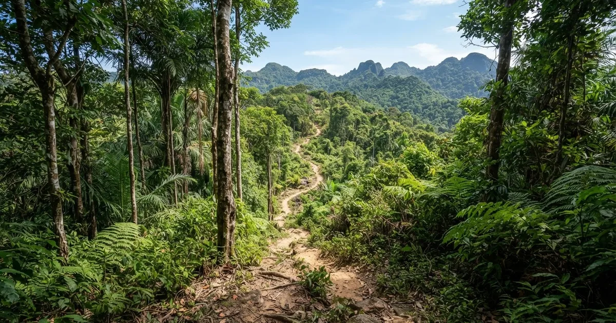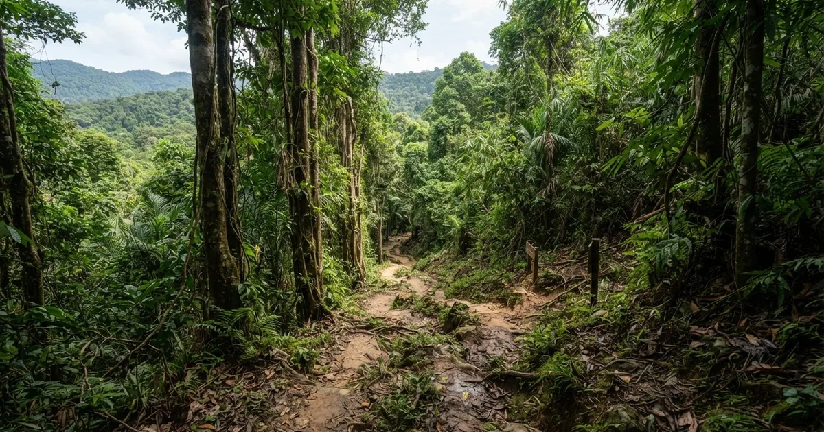
The Central National Park Trail, also called the Rung Giong Trail, is a roughly 4-kilometer forest trek that usually takes 2 to 3 hours round trip. It is generally easy to moderate for a reasonably fit traveler, but six stream crossings, slippery ground, and missing bridges make it more demanding than Phu Quoc’s simplest park walks. Visit between October and April, carry water and food, and use a hiking stick for extra stability.
How difficult is the Central National Park Trail?
Rung Giong is best described as an easy-to-moderate trek rather than a strenuous mountain hike. The route is relatively flat and does not require special trekking experience, which is why reasonably fit beginners and active families may enjoy it. However, its difficulty is not determined only by elevation. The trail passes through six streams and includes slippery forest paths, so balance, footwear, and weather conditions matter more than climbing ability.
Some descriptions call the trail challenging yet rewarding, while others describe it as suitable for families and beginners. Both assessments can be accurate. In dry weather, the route is a short forest walk with limited physical exertion. After heavy rain, the same 4-kilometer route can become substantially more awkward because rocks, roots, mud, and stream edges are wet. The lack of bridges at crossings also means that the water level directly affects safety.
Travelers who regularly walk on uneven ground should usually find the route manageable at a careful pace. It is a poorer fit for anyone expecting a paved nature path, for visitors wearing sandals with smooth soles, and for people who are uncomfortable stepping through shallow water. It is also not the right choice after a period of intense rain, even if the distance looks short on a map.
A good fit for
Travelers wanting a 2-to-3-hour forest adventure, beginners with reasonable fitness, families with older children, and visitors who do not mind wet shoes or careful stream crossings.
Less suited to
People seeking a completely dry and accessible walk, very young children who cannot manage uneven ground, travelers with unstable footing, and anyone visiting during rising-stream conditions.
What to expect on the 4-kilometer route
The Central Trail is a compact forest experience rather than a full-day expedition. You should expect dense tropical vegetation, shade for much of the walk, exposed roots, damp rocks, patches of mud, and sections where the path is not smooth or clearly engineered. The six stream crossings are the defining feature of the route. Depending on recent rainfall, they may involve stepping across rocks, walking through shallow water, or choosing a careful line along the bank.
There are no bridges at the crossings in the conditions described for this trail. That means the route changes with the season and sometimes with the weather from the previous day. A crossing that is easy in the dry season can be deeper, faster, or more slippery during the rainy season. Never assume that a familiar photograph or an earlier visitor’s report describes the water level on your day.
The trail’s relatively flat profile keeps the physical effort moderate, but the pace should be slower than on a normal road or beach walk. Allow time to test each foothold, keep your hands free where possible, and avoid rushing to stay with a group. A hiking stick is specifically recommended because it helps with balance on wet ground and provides support when stepping between rocks.
| Trail detail | What it means for visitors |
|---|---|
| Approximate distance | About 4 km round trip |
| Typical duration | Approximately 2 to 3 hours, including careful crossings and short rests |
| Terrain | Forest paths, slippery sections, roots, rocks, mud, and stream banks |
| Water crossings | Six streams, with no bridges described along the route |
| Elevation | Relatively flat, so footing is usually more important than uphill fitness |
| Recommended support | A hiking stick and shoes with dependable traction |
When is the best time to hike Rung Giong Trail?
The recommended trekking season is October to April, generally regarded as Phu Quoc’s drier period. Drier conditions do not guarantee a completely dry trail, but they normally reduce the chance of swollen streams, deep mud, and persistently slippery surfaces. This is the most sensible window for visitors who want the clearest chance of completing all six crossings comfortably.
The rainy season requires more caution. Heavy rainfall can raise the streams, wash out sections of the path, and make rock surfaces slick. With no bridges, there may be no safe way to cross a fast or unusually deep stream. A short route can therefore become a poor choice on a wet day, and turning back is the correct decision if the water level looks unsafe.
Start early enough to complete the walk in daylight and check recent conditions before setting out. A local accommodation host, driver, or rental and concierge service may know whether the route has been affected by recent rain. Conditions can differ from one part of the island to another, so a dry road near your hotel does not necessarily mean the forest trail is dry.
Safety rule for rainy weather
If a stream is rising, fast-moving, or difficult to cross without jumping, do not enter it. Wait for safer conditions or turn around. The absence of bridges means there is no reliable alternative crossing point on the route.
What should you bring for the trail?
Pack for a wet and uneven forest walk, even during the recommended season. Shoes with a firm, grippy sole are more useful than fashionable beach footwear. Lightweight hiking shoes or trail shoes are practical, while smooth-soled flip-flops create a higher slipping risk. Some visitors may prefer footwear that can tolerate water, because keeping shoes completely dry across six crossings is not always realistic.
Carry enough drinking water for at least three hours, plus snacks or a packed meal. There are no restaurants or food stalls inside or nearby the protected area, so do not plan to buy lunch after entering the forest. A small waterproof bag or dry bag is useful for a phone, wallet, camera, and spare clothing. Insect repellent, sunscreen, a hat for exposed sections, and a basic first-aid kit are also sensible additions.
A hiking stick is recommended for additional support. You do not need technical climbing equipment, but a stick can help you test mud depth, steady yourself on a wet slope, and manage the approach to a stream. Keep both hands available when necessary, and do not rely on a stick as a substitute for checking the current and firmness of each step.
Practical packing checklist
- Trail shoes with strong grip, or secure water-tolerant footwear
- Drinking water for a 2-to-3-hour outing
- Snacks or a packed meal, because there are no nearby food stalls
- Hiking stick for stream crossings and slippery ground
- Waterproof pouch for electronics and documents
- Insect repellent and sunscreen
- Light rain protection and a spare shirt
- Small first-aid kit and a fully charged phone
Planning access, food, and costs
There is currently no official Phu Quoc National Park entry fee in 2026. That does not mean every visit is cost-free: transport, a local guide, food bought before departure, and any optional services are separate expenses. Be cautious if someone presents an unofficial charge as a mandatory national park entrance ticket, and confirm the current situation locally before paying.
Food planning is particularly important for this trail. No restaurants or food stalls are located inside or nearby the protected area, according to the available trail information. Eat before you go or purchase supplies in advance, and take all packaging back out with you. A 4-kilometer walk may not sound long, but waiting at crossings and walking slowly in humid conditions can make water and calories valuable.
Arrange transport with enough flexibility for a 2-to-3-hour trek rather than asking a driver to return at a narrowly fixed time. Mobile coverage, road conditions, and trail conditions can vary around Phu Quoc’s forested areas. If you are unfamiliar with the access route, ask a local service to confirm the starting point, recent weather, and a practical pick-up plan before departure.
How does Rung Giong compare with other Phu Quoc nature walks?
The Central Trail is a useful middle option for travelers who want more than a short viewpoint or beach stroll but do not want a long, demanding trek. Its 4-kilometer length and mostly flat terrain make it less physically intense than a full-day route, while the six streams give it more adventure than an ordinary park path. Its main challenge is careful movement, not sustained uphill exertion.
The Cua Can area of Phu Quoc National Park offers moderate trails with loop options of up to 10 km. Those longer loops can take about 5 to 6 hours and are a better fit for experienced walkers who want a substantial day outside. They are a poor fit for visitors with only a short free period or anyone who has not packed enough water and food.
Cua Can Beach itself is much easier. The main beach walk is described as taking about 15 minutes, and no motorbike is needed once you reach the village. This is suitable for a relaxed shoreline stop, but it does not provide the forest-crossing experience of Rung Giong. The Cua Can area can also become muddy in the rainy season, and some tracks may be less straightforward to ride or walk.
| Experience | Typical scale | Best for | Less suitable for |
|---|---|---|---|
| Rung Giong Central Trail | About 4 km; 2 to 3 hours | A short forest trek with six stream crossings | Anyone needing a paved, dry, or fully predictable path |
| Cua Can National Park loops | Up to 10 km; about 5 to 6 hours | Fit hikers wanting a longer moderate outing | Visitors with limited time or little water and food |
| Cua Can Beach walk | About 15 minutes | Easy sightseeing and a simple shoreline stroll | Travelers specifically seeking a forest trek |
How to hike the trail responsibly
Stay on the established route and avoid widening muddy sections by creating informal side paths. The forest is a protected environment, so do not remove plants, disturb wildlife, or leave food packaging behind. Take particular care around streams: moving water can dislodge stones, and a shortcut around a wet patch may cause erosion or damage vegetation.
Keep the group together at crossings and let the slowest person choose the pace. One person should cross at a time when the stepping stones are narrow, and backpacks should be secured so they do not shift your balance. If children are joining, adults should supervise every stream crossing rather than allowing children to follow independently.
Rain can arrive quickly, and a trail that felt comfortable at the start may become harder on the return journey. Build a time margin into the plan, carry rain protection, and turn back before conditions become dangerous. The most successful visit is not necessarily the one that reaches the furthest point; it is the one that returns safely without damaging the forest.
Frequently Asked Questions
How long is the Central National Park Trail?
The Rung Giong Trail is approximately 4 km in total. Most visitors should allow about 2 to 3 hours for the round trip, including pauses, photographs, and careful movement through the six stream crossings. Your exact time will depend on rainfall, footing, group size, and how long you spend at each crossing.
Is Rung Giong Trail difficult for beginners?
It is usually easy to moderate for a reasonably fit beginner because the route is relatively flat and does not require special trekking experience. The main difficulty is slippery footing, not steep climbing. Beginners should use grippy shoes, carry a hiking stick, and avoid the trail when streams are rising after heavy rain.
How many streams do you cross on the trail?
The route passes through six streams. There are no bridges described for these crossings, so water depth and current can affect the hike. In dry conditions they may be manageable with careful steps, while rainy-season water can become unsafe. Never cross a fast or unusually deep stream simply to complete the route.
What is the best month or season for Rung Giong Trail?
The recommended trekking season is October to April, when drier conditions generally make the paths and streams easier to manage. Rain can still occur, so check local conditions before leaving. During the wetter season, rising water, mud, and slippery rocks increase the likelihood that you will need to turn back.
Is there an entrance fee for Phu Quoc National Park in 2026?
There is currently no official Phu Quoc National Park entry fee in 2026. Transport, local guiding, food, and other services are not included in that statement and may still cost money. Confirm current arrangements locally, especially if someone asks for a separate charge described as a mandatory park ticket.
Are restaurants or food stalls available near the trail?
No restaurants or food stalls are available inside or nearby the protected area according to the current trail information. Bring enough drinking water and snacks for at least a 2-to-3-hour outing. Eat beforehand or buy supplies before reaching the trail, and carry all rubbish out with you.
What shoes should I wear on Rung Giong Trail?
Wear trail shoes or lightweight hiking shoes with a firm, grippy sole. The six stream crossings mean your footwear may get wet, so secure water-tolerant shoes are often more practical than smooth-soled sandals or flip-flops. Good traction is more important than heavy boots because the route is relatively flat but can be slippery.
Is the trail suitable for children and families?
Active families may manage the trail in dry conditions because it is relatively flat and only about 4 km. It is not a fully easy family path: six crossings, wet rocks, mud, and no bridges require close supervision. It is a poor choice for very young children who cannot walk steadily on uneven ground or for family visits after heavy rain.
Should I hire a guide for the Central Trail?
A guide is not necessarily required for a reasonably fit traveler during clear, dry conditions, but local help can be valuable for checking recent stream levels and confirming access. A guide or local concierge is especially useful after rain, for first-time forest visitors, or when your group includes children. Ask about current conditions before setting out.
Contact Sabrina Rental for local help with transport, current trail conditions, food planning, and a practical Phu Quoc day itinerary around Rung Giong.
Contact Sabrina