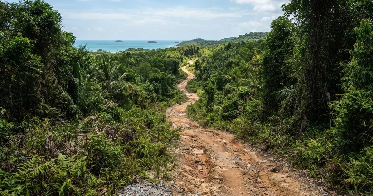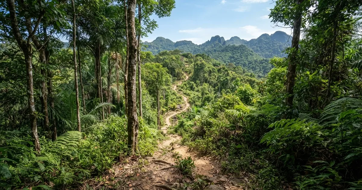
Suoi Da Ngon is the hardest waterfall hike on Phu Quoc. The main route runs 5.2 km with 180 m of elevation gain and takes 2.5 to 3 hours over steep, slippery granite — terrain local operators rate medium-hard to hard and reserve for fit adventure travelers. A shorter 3 km variant is listed as moderate, but whichever line you take, go with a local guide, start early, and hike in the dry season from November to April.
Where Is Suoi Da Ngon, and Why Does It Feel Different from Phu Quoc's Other Waterfalls?
Suoi Da Ngon sits in Cua Duong commune on the northern half of Phu Quoc, about 12 km from Duong Dong. Getting there means heading inland from the coastal road toward Ganh Dau, into the buffer zone of Phu Quoc National Park — roughly 25-30 minutes by motorbike from town. The falls drain the forested hills of the island's interior, which is exactly why they have stayed so raw.
The contrast with the island's two famous waterfalls is immediate. Suoi Tranh and Suoi Da Ban both have paved access roads, concrete steps, food stalls and a steady rotation of tour vans. Suoi Da Ngon has none of that: no stalls, no railings, no real signage, and on a quiet weekday you may share the entire stream with nobody. Travel writers describe the reward as an untouched, powerful waterfall, and the appeal is precisely the remote, less-developed forest experience and the solitude in nature.
That same rawness defines who this hike is a poor fit for. If you want an easy photo stop, are traveling with small children, or feel uneasy on wet rock, Suoi Tranh gives you most of the scenery for a fraction of the effort. Suoi Da Ngon is a half-day expedition with no exit shortcuts, not a quick leg-stretch beside the parking lot.
How Hard Is the Suoi Da Ngon Trail, Really?
Honestly: the published ratings disagree, and it helps to see why before you commit. Different guides start from different trailheads, measure different lines, and hiked in different seasons — all of which changes the answer. Here is what the main sources actually report:
| Source / route | Distance | Time | Rating |
|---|---|---|---|
| Phu Quoc Island Guide listing | 3.0 km | ~3.0 hours | Moderate; one listing calls it suitable for beginners |
| Full route from the standard trailhead | 5.2 km | 2.5-3 hours | Challenging; 180 m elevation gain |
| Local tour operators | 4-7 km depending on route | 3+ hours | Medium-hard to hard; experienced trekkers only |
| Final approach from the nearest access point | ~1.5 km | 45-60 minutes | Medium-hard to hard terrain |
Read together, a clear pattern emerges. The shorter 3 km version, hiked in dry conditions, genuinely is moderate — fit beginners manage it, which is why one listing markets it that way. The 5.2 km route with 180 m of climbing, or any version after rain, is a different animal: operators recommend it only for experienced trekkers or fit adventure travelers. One operator is blunt about the specific hazard — slippery, steep granite terrain that is only suitable for adventure travelers in good physical shape.
Experienced hikers
Expect a moderate-but-satisfying half day. The 5.2 km route with 180 m of gain is well within your range — you book a guide for route-finding, not fitness.
Fairly fit beginners
Tackle the 3 km dry-season version with a local guide, start by 8 am, and turn back at the first granite slab that feels beyond you. The trail will still deliver.
Unfit or casual travelers
A poor fit. The granite sections are unforgiving and there is no shortcut once past the approach. Choose Suoi Tranh or the boulders at Suoi Da Ban instead.
The Trail Step by Step: What You Will Actually Walk Through
The opening stretch is the easy part. From the trailhead area near Cua Duong, a dirt forest track slopes gently under secondary jungle canopy — leaf litter, birdsong, the occasional farmer's path branching off. Nothing technical yet. This is the section where first-timers wonder what the fuss is about, and it typically covers the first kilometer or so of the route.
Then the trail narrows and starts following the stream bed itself, and the character changes completely. The terrain becomes the wet, polished granite that gives this hike its reputation: angled slabs that stay slick even in the dry season, ledges where you use hands as well as feet, and pool crossings where the smart line is not always obvious. Local guides describe roughly 1.5 km of this approach terrain as medium-hard to hard, and it is where most stumbles happen. Good shoes with real grip are not optional — they are the single most important piece of equipment you carry.
The final push involves the 180 m of elevation gain compressed into the upper section, clambering beside a series of cascades before the main fall appears in a shaded basin. Swim if the water level is safe, eat, and budget the return trip at slightly less time than the ascent. Total: 2.5 to 3 hours of moving time on the 5.2 km route, closer to 3 hours even on the 3 km version because the granite slows everyone down.
How to Get to the Suoi Da Ngon Trailhead
From Duong Dong, ride north out of town on the road toward Cua Duong and Ganh Dau — about 12 km in total. The first stretch is sealed and easy; the final kilometres turn to rougher dirt and compacted red soil, so ride slowly after rain. A standard semi-automatic motorbike handles the route in the dry season; in the wet months, expect deep puddles and consider going with a driver instead. Budget 25-30 minutes each way from town.
Two practical points worth planning around. First, there is no formal ticket booth or ranger post at the trailhead, so carry small notes for any informal parking fee a local villager may ask — usually 10,000-20,000 VND. Second, there is no phone signal for most of the trail, no food stalls, and no water source you should trust untreated. Bring everything you need from Duong Dong, tell your accommodation where you are going, and aim to start walking by 8-9 am so you are back at the bike by early afternoon.
Dry Season vs Rainy Season: When Should You Go?
The consensus for safety is clear: November to April, Phu Quoc's dry season. The granite dries between mornings, the stream drops to crossable levels, and the forest track is firm underfoot. Visibility through the jungle improves too, which matters more than you would think on a trail with minimal blazes.
May to October is the rainy season, and this is where the trade-off appears: the waterfall is at its most powerful and photogenic, and some guides note the trail can technically be visited year-round. But after heavy rain the granite becomes genuinely dangerous, the stream can rise within minutes, and the same operators who market the dry-season hike will simply refuse to run it. If your trip falls in the wet months, treat Suoi Da Ngon as weather-dependent — go only after a stretch of dry days, and never during or immediately after a storm.
Local tip: Even in high season, start before 9 am. You get cooler temperatures for the climb, firm rock from the overnight dry-out, and the falls to yourself before any other hikers arrive from Duong Dong.
Do You Need a Local Guide for Suoi Da Ngon?
Yes — and this is one trail where the recommendation is unusually emphatic. Multiple guides say a local guide is strongly recommended; at least one states outright that you must hire one to attempt the trek. The reasons are practical rather than commercial: the trailhead turn-offs are unmarked, the route-finding through the granite section is not intuitive, and there is no phone signal or ranger presence if something goes wrong.
A half-day guided trek with transport typically costs in the region of $25-45 USD per person depending on group size, or you can hire just a local guide in Cua Duong for less if you already have a motorbike. Guides carry rope for the trickier slabs, know which pools are safe to swim, and can read the sky — an underrated skill on an island where afternoon downpours arrive fast. If you rent a motorbike from us at Sabrina Rental, ask at the counter and we will connect you with a trusted local guide and check your bike's brakes before you head inland.
Going completely solo is the one option we would rule out, even for experienced trekkers who have navigated unmarked trails elsewhere in Southeast Asia. This is also a poor fit for travelers who dislike paying for guides: if that is you, pick a signed, developed waterfall instead and enjoy it honestly.
What to Pack for the Suoi Da Ngon Hike
Shoes with aggressive rubber soles — trail runners or hiking shoes; slick-soled sneakers or flip-flops end the hike early on granite.
At least 1.5-2 liters of water per person; there is nowhere to buy anything on or near the trail.
Quick-dry shorts and a spare shirt — you will get wet at the crossings, whatever the season.
Insect repellent and sunscreen; the jungle mosquitoes are active from mid-afternoon.
A dry bag or zip-locks for your phone and any electronics.
Small VND notes for informal parking, plus a fully charged phone downloaded with an offline map.
A light rain shell in shoulder months, even on a blue-sky morning.
Leave the drone at the accommodation unless you have cleared it locally, keep your valuables in the bike's storage box out of sight, and do not hike with more than a small daypack — the granite sections sometimes require both hands.
Suoi Da Ngon vs Other Phu Quoc Hikes: How It Compares
If Suoi Da Ngon sounds like too much, Phu Quoc's national park has graded alternatives — and if it sounds like too little, there is one comparable step up in commitment. Here is the honest landscape:
| Hike | Distance / time | Difficulty | Best for |
|---|---|---|---|
| Suoi Tranh waterfall | Short stroll from parking | Easy; steps and stalls | Families, quick photo stops |
| Suoi Da Ban boulders | Easy walk on wide rock slabs | Easy-moderate | Sunset picnics, casual walkers |
| Rung Giong / Central National Park Trail | 4 km, half day | Moderate-challenging; six stream crossings, slippery paths | Fit hikers wanting forest without granite climbing |
| Suoi Da Ngon | 3-5.2 km, 2.5-3 hours, 180 m gain | Medium-hard to hard | Experienced trekkers chasing solitude and a raw waterfall |
The Rung Giong Trail deserves a specific mention because it is the natural next step. It crosses six streams on slippery paths, and a hiking stick is genuinely recommended for support. Its operators advise hiking it in the dry season from October to April, because during the rainy season rising water and the absence of bridges increase the risk of accidents — the exact same logic that applies to Suoi Da Ngon, just with less vertical climbing and no granite slabs. (One newer guide describes the park's central loop as relatively flat and family-friendly; conditions clearly vary by exact route, so confirm the line before you set off.)
If you love Suoi Da Ngon and want more, ask about the longer park traverses toward the interior peaks — but treat those as guide-only expeditions as well.
Frequently Asked Questions
How long is the Suoi Da Ngon hike?
It depends on the route: the commonly listed versions run 3.0 km (about 3 hours, moderate) and 5.2 km (2.5-3 hours, 180 m of elevation gain). Local operators quote anything from 4 to 7 km depending on the trailhead and how far up the cascades you climb. The final approach from the closest access point is about 1.5 km of medium-hard to hard terrain.
Is Suoi Da Ngon suitable for beginners?
Only in the short version and only in the dry season. The 3 km listing is rated moderate and marketed to beginners, but the full 5.2 km route with 180 m of climbing is rated challenging and is recommended for experienced trekkers or fit adventure travelers. First-timers should go with a guide, start by 8-9 am, and be honest about turning back.
When is the best time to hike Suoi Da Ngon?
November to April, Phu Quoc's dry season, when the granite is driest and the stream is lowest. The waterfall is most powerful from May to October, but rain makes the steep rock treacherous and can raise the water level fast. Most guides simply do not run the hike after heavy rain, whatever the calendar says.
How far is Suoi Da Ngon from Duong Dong?
About 12 km from Duong Dong to the Cua Duong trailhead area — 25-30 minutes by motorbike. The last kilometres are rough dirt, so ride carefully after rain. There are no fuel stations or shops near the trailhead, so sort out your bike, water and snacks in town before you leave.
Do I really need a guide?
Yes. Multiple guides strongly recommend one and at least one source says you must hire a local guide to attempt the trek. Expect roughly $25-45 USD per person for a half-day guided trek with transport. You are paying for unmarked turn-offs, route-finding on the granite, safety rope, and the absence of phone signal or rangers on the trail.
Can you swim at Suoi Da Ngon?
Yes, in the pools below the cascades, and it is one of the best wild swims on the island in the dry season. Your guide will point out the safe pools. In the rainy season, current strength and hidden submerged rocks make swimming a genuine risk — follow local advice and stay out when the water is high and brown.
Is Suoi Da Ngon harder than Suoi Tranh?
Dramatically. Suoi Tranh is a short stroll from a car park with concrete steps and food stalls; Suoi Da Ngon is a 2.5-3 hour trek over slippery granite with 180 m of elevation gain. If anyone in your group struggles on wet rock or dislikes jungle hiking, choose Suoi Tranh or Suoi Da Ban and skip this trail entirely.
Can I hike Suoi Da Ngon in the rainy season?
Technically the trail can be visited year-round, and that is when the falls are most spectacular — but operators advise against it after rain because the steep granite becomes very slippery and the stream can rise quickly. If you visit May to October, go only with a local guide after several consecutive dry days, and turn around at the first sign of rising water.
Planning to tackle Suoi Da Ngon? Sabrina Rental in Duong Dong rents well-serviced motorbikes perfect for the ride to Cua Duong, and our team can arrange a trusted local trekking guide and check your bike before you go.
Contact Sabrina Rental